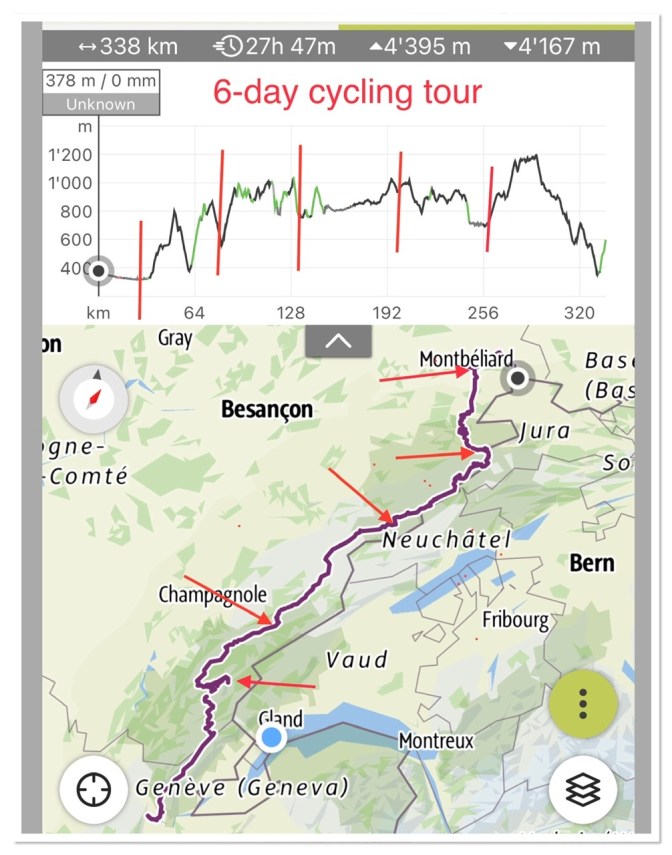
Stats of our entire trip: 6 cycling days, 340km and 4,400m elevation gain
Overview of Grand Traversèe du Jura (GTJ):
GTJ runs in the French Haute-Jura at the border with Switzerland. By bike, it covers 360 km between Montbéliard (Doubs department) in the north and Culoz (Ain department) in the south. It passes through the towns of Morteau, Pontarlier, Mouthe, Morez and Bellegarde-sur-Valserine.
As you will read at the end, our trip got called off one day short from completion, so we did not reach Culoz. That will hopefully happen at another time.
For more OFFICIAL information: https://www.gtj.asso.fr/en/routes-and-activites/gtj-bike-riding-route/
June 2022
Day 1: warm-up Boncourt CH to Montbeliard F:
31 km; 200m elevation gain
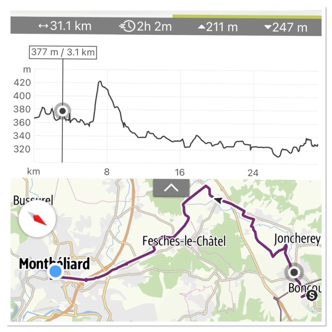
Our journey starts in Boncourt , the last village on the Swiss-French border, well connected by railway.
We stepped out of the train and WOW what a heat! 34C on the Jura hills at 340m!
Thankfully this day is just a warm-up (yeah literally!) to reach the official departure point of the Grand Traversèe du Jura (GTJ) in Montbéliard.
But starting at 2pm under the scorching sun is not a good idea and so we found shelter for an hour or so before venturing to our night destination. A little Coop with convenient bar stools provided food and shade.
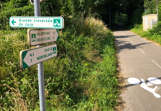
And then we hopped across the border to Delle, just 2 km away.
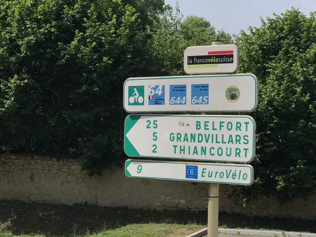
But what a surprise! As soon as we crossed the border, in a seamless and unmarked transition of roads from a village to the next, we found perfectly marked and separated bike trails, with very precise “green” directions for any destinations (the famous voies vertes of France). And the route signs told us that we were also hopping on part of the Eurovelo 6 ( https://en.eurovelo.com/ev6/france ) , the bike route that connects the French Atlantic Ocean to Basel in Switzerland and beyond to the Black Sea in Bulgaria.
France, what a wonderful biking country! However, initially unaware of the simplicity and beauty of this cycling network, we veered off the beaten path to shorten our Route but we got lost several times and, in any case, we increased our actual biking time because of checking constantly the direction.
So, if you find a bike path (or Voie Verte), stay on it! Even if it seems you increase the length of your journey , at the end you gain in time, and in a much more scenic and comfortable way.
And after a few mistakes we reconnected with the ”voie verte” towards our destination.
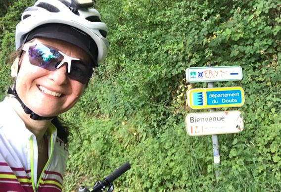
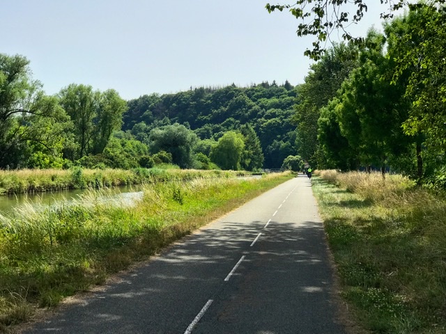
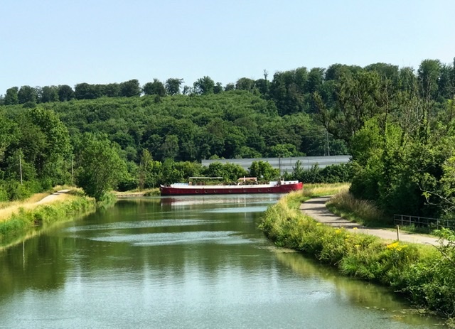
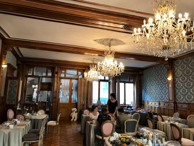
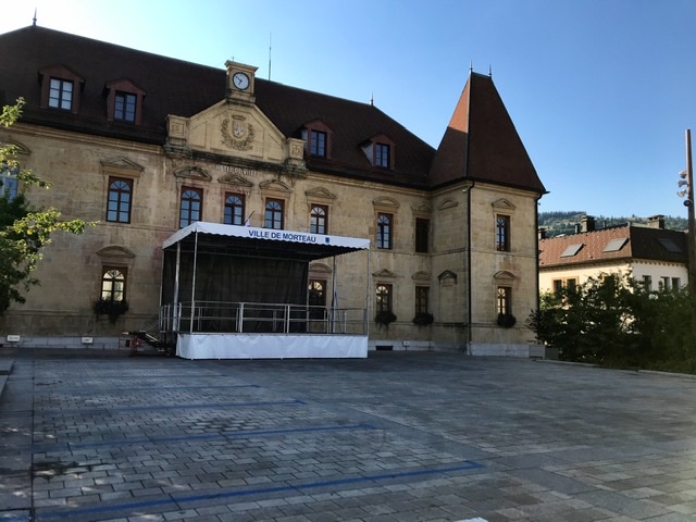
Coasting channels and the river Doubs along interconnected voies vertes, we finally arrived in Montbéliard, a small quiet town with nice historic buildings and houses and a Castle-Museum.

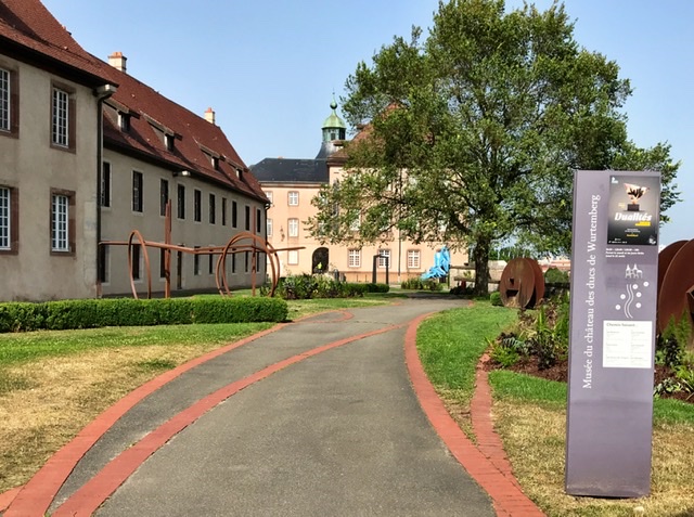
We spent the night in a small historic hotel in the old town and I highly recommend it (The Originals City, Hôtel de la Balance). It also has a small bike room with electricity to charge the bikes!
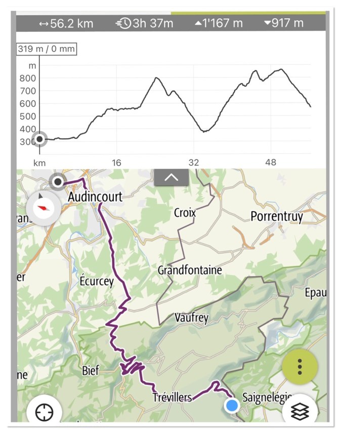
Day 2: Montbeliard to Goumois
56 km; 1,170 elevation gain
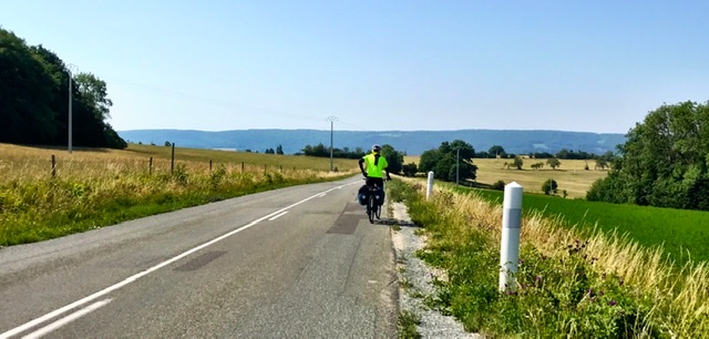
GTJ officially starts in Montbéliard. Once outside the town, the trail leaves the dedicated bike lane and continues along regular country roads.
The traffic is very light and cars are not an issue. At every bifurcation the GTJ direction is always very well indicated with the usual green arrows.
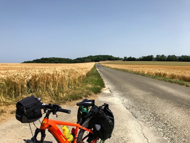
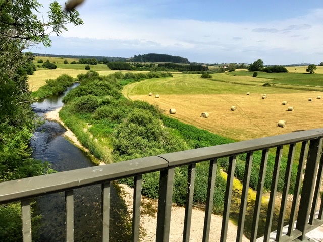
The route continues along gentle hills, sometimes in full sun, flanked only by fields of grains, other times in the shade of trees.
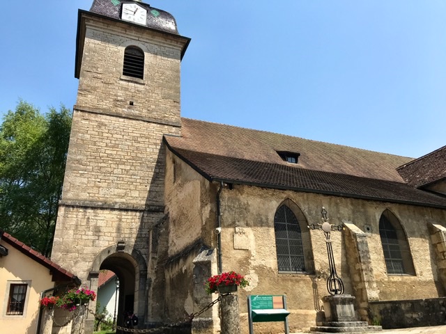
About half-way is the medieval village of Saint-Hippolyte-sur-le-Doubs, very picturesque, with a 14th-century church and an old convent of Ursuline nuns.
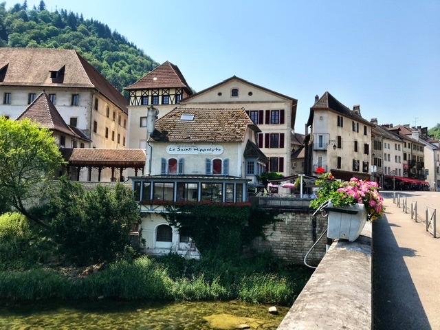
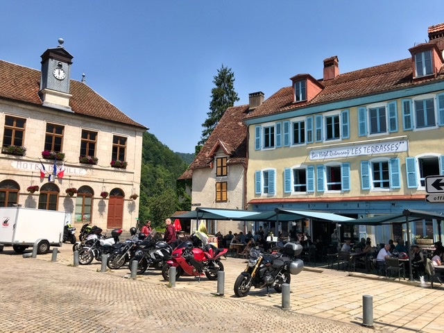
It was the only big village we encountered with a few bars and restaurants to get refreshments. Indeed, we could not find a single fountain with potable water in all the villages we passed and so here is a note of warning: bring enough water for the entire travel-day. This is in fact a big difference with Switzerland, where fountains of potable water abound in and between villages!
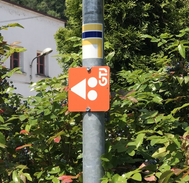
After a coffee we continued to our night destination. However by mistake we detoured into the VTT route of the GTJ. In fact, this is marked by tiny orange signs saying “GTJ” and I didn’t know that these were specific for VTT.
But luckily the trail was doable, though rough, and we stayed on it for about 10km of uphill path. The big advantage here was that it was completely shaded during the mid-day sun, making the ride very enjoyable.
We spent the night in the Jura village of Goumois, right at the border with Switzerland on the river Doubs.
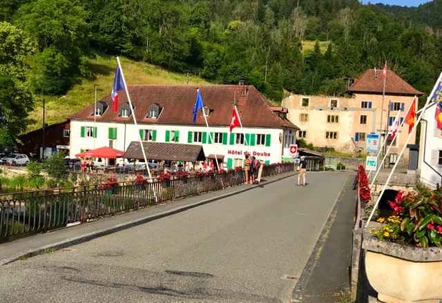
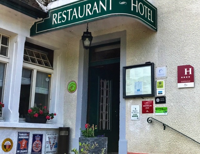
Our Hotel, Taillard , was completely immersed in green, very quiet and pleasant. Highly recommended. A private terrace allowed for a quick laundry and drying of our clothes. It has also a Michelin star restaurant, which we skipped in favour of a more hearty and filling meal that we took at a restaurant on the river’s banks.


Day 3: Goumois to Morteau
56 km; 1,250m elevation gain
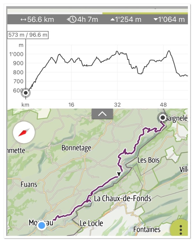
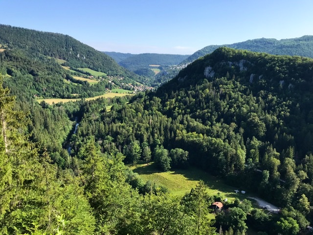
This was a very peaceful ride on the Jura’s hills, though challenging for elevation and wind conditions. Only a few farms and hamlets are found along the way, and only a handful of cars crossed our path.
Thankfully we had a very filling breakfast and took a lot of water with us because we did not see a bar, restaurant or fountain for the entire 55 km, that is until we arrived in Morteau, our night destination !
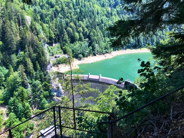
Although this section follows the Doubs, the river is in the valley and hidden from view. The only time we saw water was when we detoured to the dam (Barrage du Chatelot).
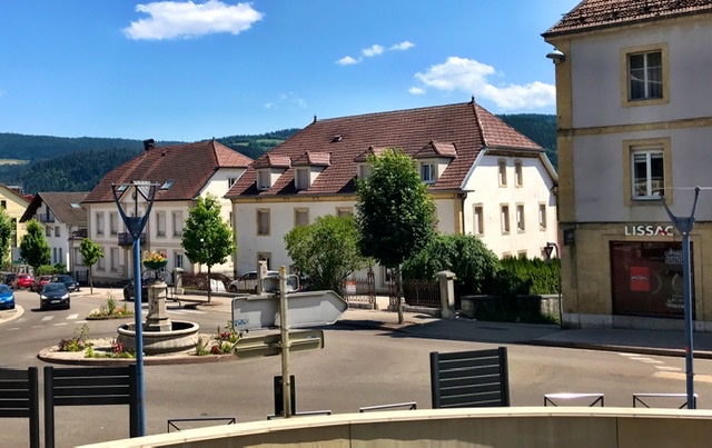
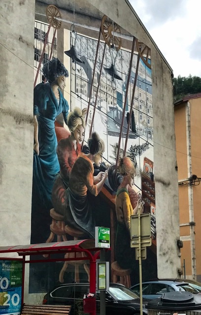
Arrived in Morteau, large superstores greeted us at the periphery. The center has many old buildings and patrician houses, testimony of a more glorious past probably linked to the watch/clock trade. But today the town looks poor and the main tourist attraction is still the Clock Museum (Musee de l’horlogerie) ( http://www.musee-horlogerie.com/ ).
Day 4: Morteau to Mouthe
77 km, 730m elevation gain

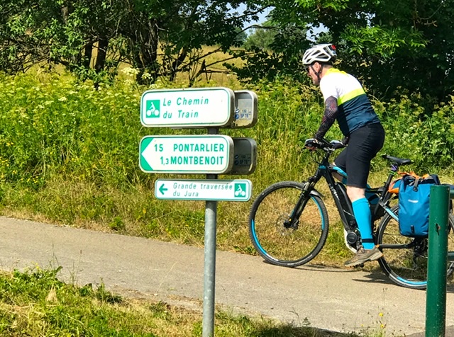
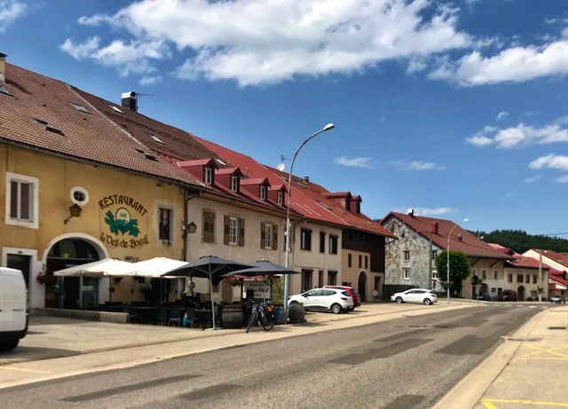
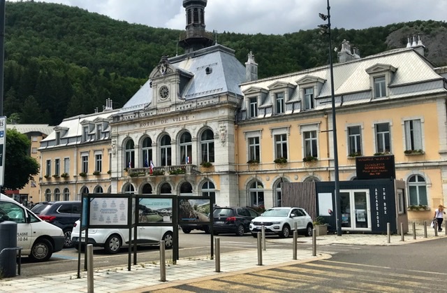
I would say today was a bit boring, with the same hilly scenery throughout. It was also quite long though not too steep. We also finally passed several villages, the largest one being Pontarlier, but none of them struck us as pretty nor interesting; and all of them were very quiet, sleepy towns, seemed off the tourist path at least during the June season.
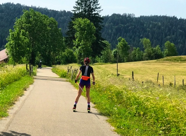
The nice surprise was that we found again a dedicated bike path for 15km up to Pontarlier, called Le Chemin du Train (I guess from a converted old railroad tracks).
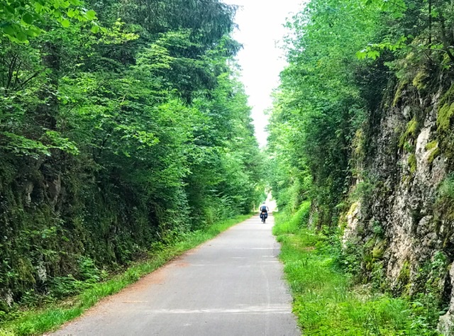
This was quite bucolic and calm. Interestingly this path was also shared by people practicing “street cross-country ski” or “roller ski”, to keep their skills up during the summer. Indeed, in winter the region is a cross-country ski paradise.
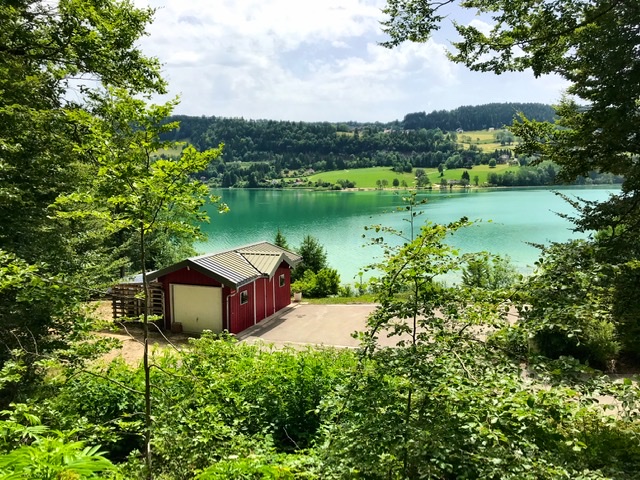
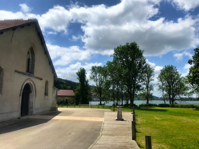
Several lakes are also bordered along the way.
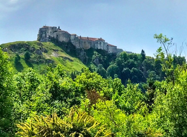
Two landmarks to visits in the section are the imposing castle of Joux (Château de Joux, https://chateaudejoux.com/ ) near Pontarlier (but we did not have time) and the Source of the river Doubs at our destination in Mouthe.
The Source du Doubs was just 2 km from our lodging, at 946m , and easily reachable by bikes. The source is very mystical and calm. It rises out of a cavern, with a gentle flow that forms large puddles between boulders enveloped by moss. And then the water enters the stream that will become the river Doubs flowing north for 453 km. The subterranean course of the source remains still largely unknown to this day.

Mouthe was once again another deserted town, probably still off-season, though it did not seem to have much in touristic infrastructures.
Day 5: Mouthe to Morez
60 km; 560m elevation gain

Rain, rain, and more rain delayed our departure well after 10am.

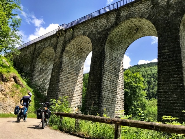
The biking was also disappointing today as the scenery was actually very similar to yesterday, with the exception of the last 10km, which ran on a secluded road intersected by several railroad bridges.

Overall this trip starts getting boring with not much changes in landscape nor towns. And Morez, OMG, another depressing and depressed town in the French Jura’s. It was once famous for the eyeglass industry, but today it looks very poor and unattractive.
In reality, I have not seen one single pretty village so far in this trip, well except for Saint-Hippolyte and maybe Montbéliard. On the contrary, the Swiss counterpart, Route 7 (Jura) from Basel to Nyon, is much more picturesque, with varied scenery and cute Swiss villages.
Day 6: Morez to Ochiaz
80km; 1,210m elevation gain
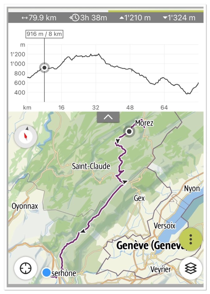
This part was the longest and toughest of the entire trip, using up almost the entire battery.
The scenery was pretty varied compared to previous days, from open fields to woods to steep rocky walls in the Jura.


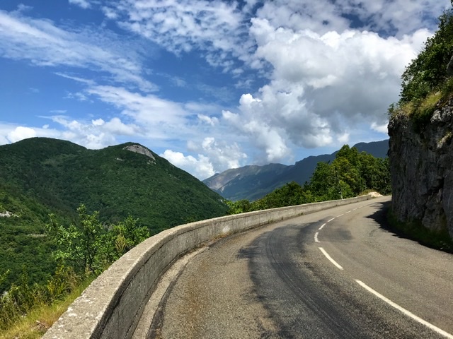
The villages also were prettier and more manicured, acquiring a Swiss flavor.
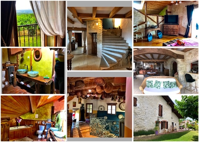
And at the end we were rewarded with a beautiful B&B in a restructured old farm on the hills of Ochiaz, near Bellegarde-Sur-Valserine, south of Geneva.
Day 7- last day Ochiaz to Culoz got botched—> return home
Our original plan to complete the GTJ route at Culoz got scratched by downpours lasting from the morning into the early afternoon, so we decided to call it quits one day earlier. We had been fortunate so far that all the thunderstorms happened at night, but today the plan changed.
Thankfully we were close to the station of Bellegarde and so it was an easy decision to just jump on a train for Switzerland.
We had already biked enough and we were tired. Also the landscape was not that striking nor worth suffering through bad meteorological conditions……
Nevertheless, I will probably visit this one missing segment at another time, maybe with a round-trip to Geneve.
Overall final impression of the GTJ:
At the end we biked for 6 days for 340km and 4,400m elevation difference. It was a good exercise and not too far from home; the path had always very low traffic even when on regular road, and it was always surrounded by nature, either as pastures or woods. But the Route itself is not impressive, neither for natural landmarks nor for remarkable villages, so it is not a trip that I would recommend for an amazing experience. For outside Switzerland, our previous cyclotouring trips in Lofoten (Norway) and on the Route des Grandes Alpes (France) are still unbeatable for scenery and variety.
