Highlights : Urnerboden, Klausen Pass, Unterschächen, Altdorf
Route 4: Section 3 (Glarus 470m–Flüelen 430m)
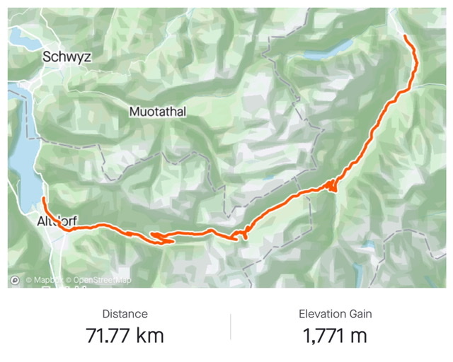
Stats from SwitzerlandMobility.ch (http://www.veloland.ch/en/routes/etappe-0875.html): 68km long, height difference 1,650m in either direction. Their site has the full profile.
Note that there are about 20km of intense climb in either direction to reach the Klausenpass (1,950m). The pass is open from approx. May to October
July 2020
Wowowow! This must be the most difficult section of all the 9 Swiss National Road-Bike Routes. I barely made it to the top….. But what a scenery! This one goes into my special list of the most beautiful bike routes I have ever done!
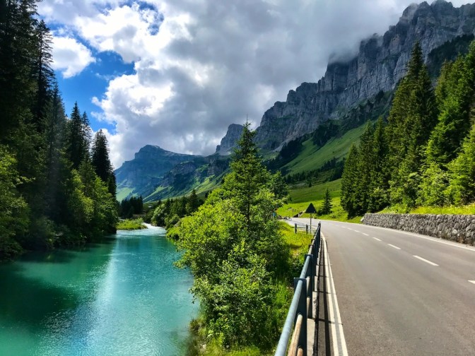
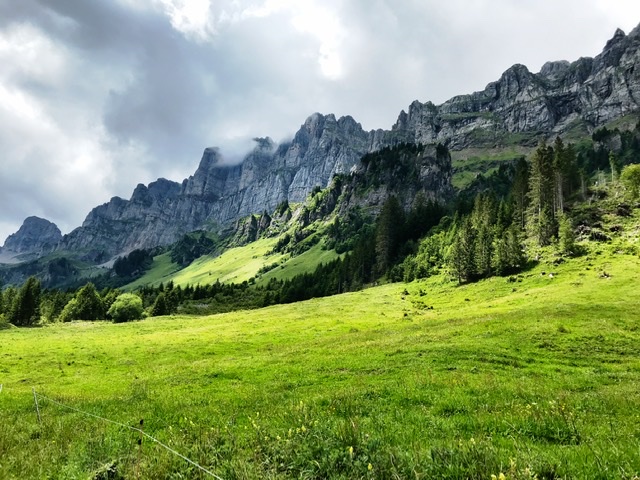
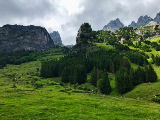
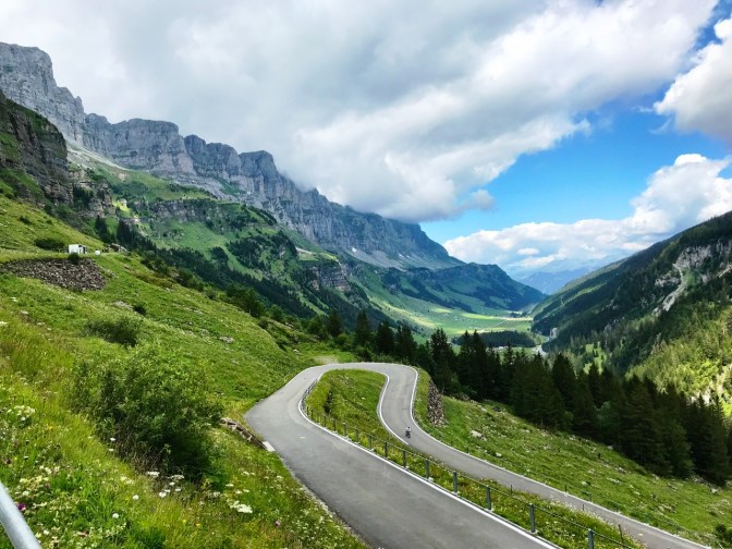
At either side of the Klausen Pass there’s a magical narrow valley surrounded by tall vertical rocky walls.
It definitely rivals in beauty the landscape of the Laterbrunnen valley.
It is a high altitude route that is best to travel in July and August, especially with clear weather to appreciate the majestic panorama.
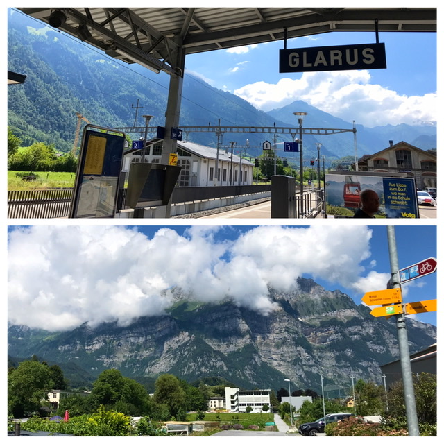
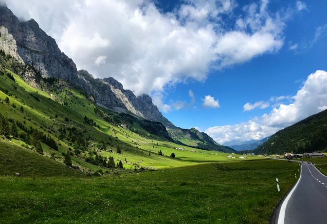
I started in Glarus ( https://www.schweizmobil.ch/en/ort-0176.html ), the smallest canton capital in Switzerland (Canton Glarus) and a paradise for outdoor excursions. It sits in a narrow valley enveloped by tall mountains.
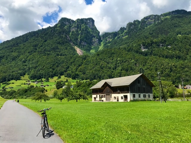
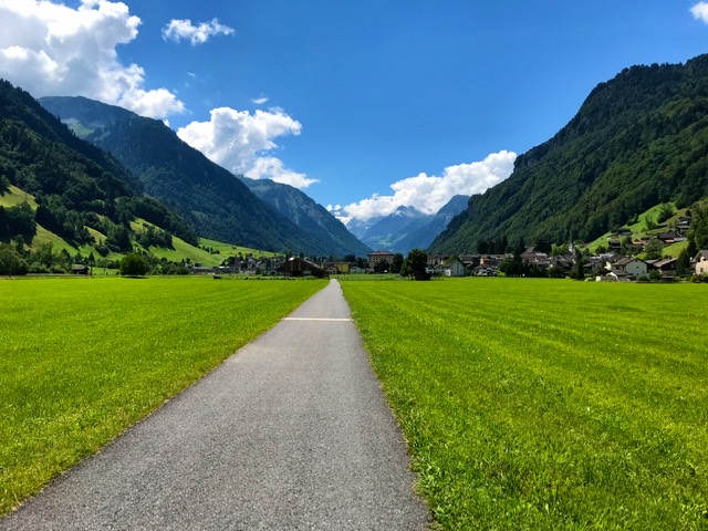
From there, the route follows the Linth upstream along a bucolic and quiet valley until the small town of Linthal.
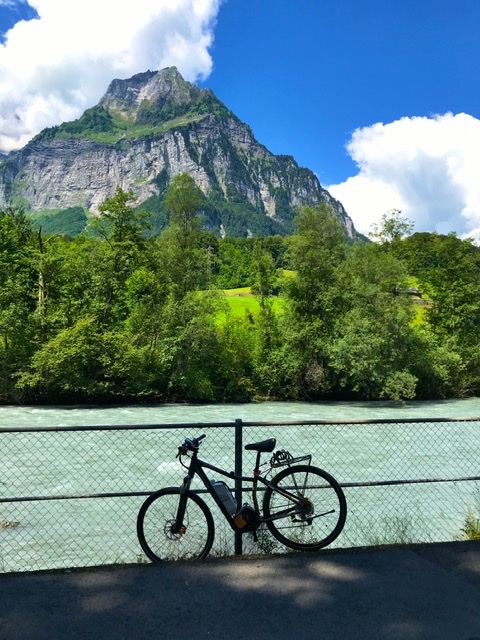
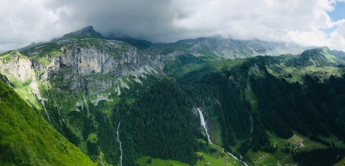
The surrounding mountain walls are dotted with waterfalls, a natural setting reminiscent of fables. The ride is easy and relatively flat for the 18km to Linthal, with no traffic and along a dedicated bike path.
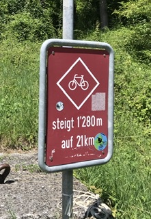
And then the dreaded ascent starts, a killer 21km climb with 1,280m elevation.
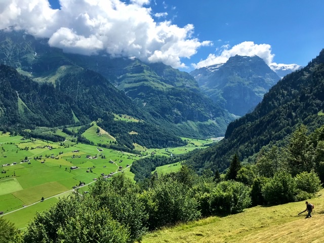
After about 8km uphills, right at the moment when I was contemplating turning around because of my dwindling battery, an amazing hidden paradise opened up: a flat high-plateau valley, several kilometers long, where I could switch the battery off and save it for later. Here, at last, I found a bit of respite from the grueling ascent.
Urnerboden, start of Canton Uri, is considered the widest alp in Switzerland, a high plateau perfect for the grazing cows. Going through this area is just spectacular. The rugged rocky peaks hug you from both sides.
But then, again, at 1,400m of altitude, you know you still have a good 600m elevation to cover along the next 7km. And the question of turning back is even more present in your mind. Your eyes are constantly scrolling between panorama, remaining battery and kilometers count……..
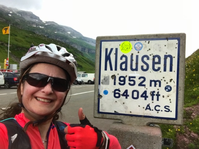
My thighs are giving up………I dismount the bike and walk it for a few minutes……. I ride it again a few more minutes……. I see a bus stop!…… I stop to ponder if I can get a lift with my bike up to the pass…….I realize that these buses probably will not take e-bikes…….I bike again a few more minutes…….I contemplate to stretch my left arm out and grab one of the motorcyclists roaring by…….not safe……walk the bike…….ride the bike…….only 2km left……yes! I can do it……the Pass is within reach……. a last effort……and then slowly I’m there …….at the TOP……at the Klausenpass! ……… enveloped in dark clouds 😦
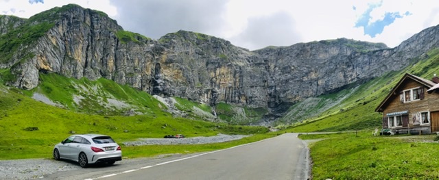
A small restaurant greets tourists or exhausted bikers with some food and rest.
What a personal achievement! I had dreaded this long ascent for a few years now.
But the beauty of the route is not finished. After the Pass, there’s the next half of this magical ride, with a continuous 1,600m drop along a 25km descent. The view of the facing Alp Aesch is also incredible, with a huge waterfall pouring out of the mountain wall.

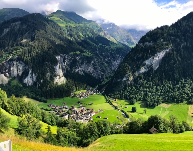
The spotting of the village of Unterschächen, nestled between vertical rocks, is magical, reminiscent of the Lauterbrunnen valley. And here, at 1,000m, the road softens its descent.
Other featured villages towards the end are Bürglen, considered the home of Wilhelm Tell and housing the Tell museum, and Altdorf.
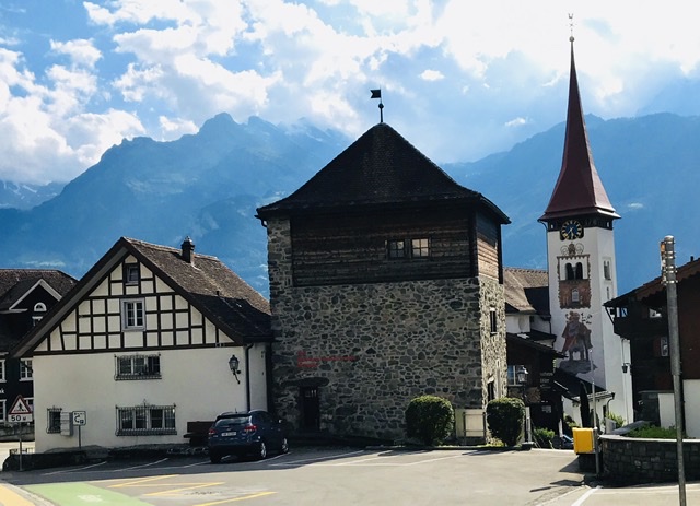
Altdorf is a charming small town known for its 17th century buildings in ornate late-Gothic and rococo styles . The picturesque square has also a Monument to William Tell.


Finally in Flüelen, the section ends right at the train station, which unfortunately blocks the view onto the lake. Indeed Flüelen (see 3:04) is at the southern tip of Urnersee lake, the picturesque fjord-like eastern branch of Lake Lucerne. If time allows, it is worth going around the train station to peek at the view.
Links to Introduction and Other Sections:
- BIKING THROUGH SWITZERLAND (with an electric bike)
- Route 4: Section 1 – St. Margrethen to Appenzell
- Route 4: Section 4 – Flüelen to Sörenberg
- Route 4: Section 5 – Sörenberg to Thun
- Route 4: Section 6 – Thun to Fribourg
- Route 4: Section 7 – Fribourg to Montbovon
- Route 4:Section 8 – Montbovon to Aigle
