Highlights: Bergun, Albulapass (2,312m), S-chanf
Route 6: Section 3 (Bergün 1,367m-Zernez 1,472m, with peak at Albulapass 2,312m)
Stats from SwitzerlandMobility.ch ( https://www.schweizmobil.ch/en/cycling-in-switzerland/routes/route/etappe-0885.html ): 45km, height difference 1250m (1150m in opposite direction). Their site has the full profile.
This section shares part of its path with Route 65:02.
May 2021
This Section crosses 2 regions: Albula districts from Bergun to the Pass and Engadin from the Pass to Zernez.
I have to say from the start that we could not bike over the Albula Pass (2,312m) because its opening was delayed due to thick snow cover even into mid-May.
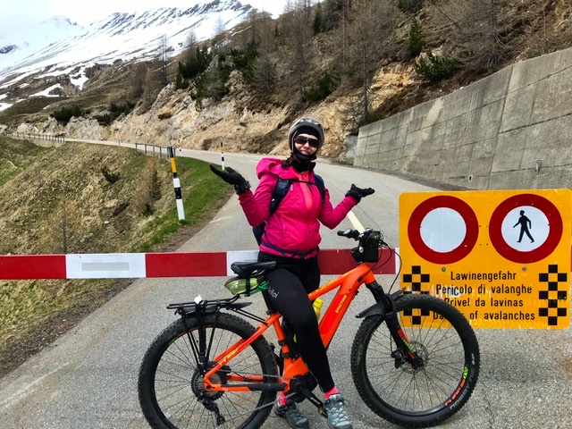
Very disappointing, but this is the risk of planning a Pass-crossing before June.
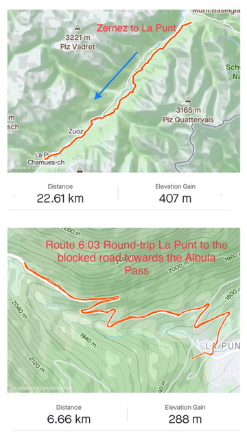
Nevertheless, we managed to ride the 25km in Engadin from Zernez to the road-block above La Punt.
And I’ll arbitrarily call Route 6 as completed ……. If and when I’ll return to the area, I’ll make sure to scratch this Pass off my list.
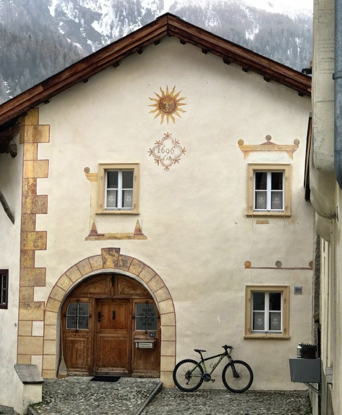
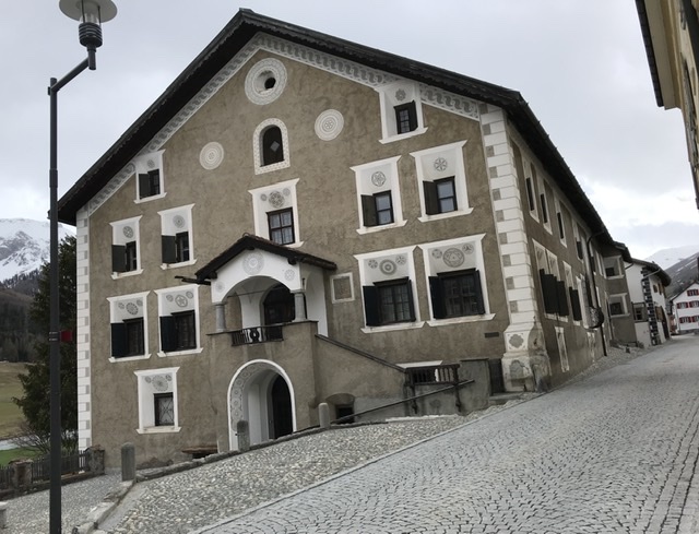
But besides the Pass, this Section 6:03 and even more so 6:04, are dotted with cute old villages with typical Engadine houses. These are characterized by exquisite façades with geometrical “sgraffiti” decor framing often the asymmetric thick walls of 16th-17th century dwellings.
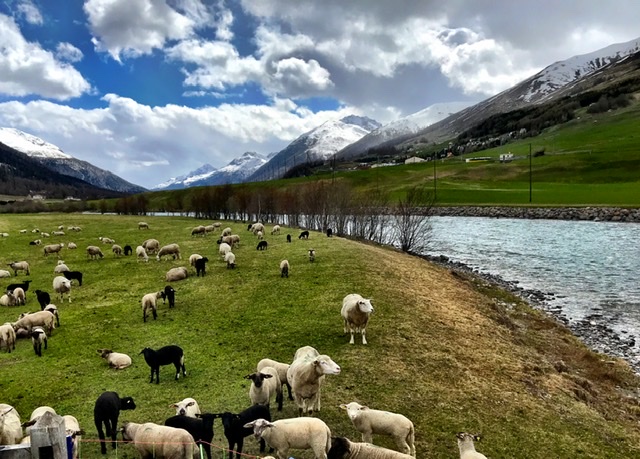
The trail from La Punt to Zernez and beyond into Austria follows the Inn river (En in Romansh). Incidentally, Engadin means “garden (giardina)” of the En in Romansh. The river indeed originates in the Upper Engadin, past St. Moritz.
We slept in Zernez at the charming chalet-style Hotel Crusch Alba.
We decided on Zernez as “base camp” because it is in the middle of the Lower Engadine and a great departure point for trips in different directions. It is also the gateway to the Swiss National Park, Switzerland’s oldest nature park in the Alps, founded in 1914 (https://www.nationalpark.ch/en/)
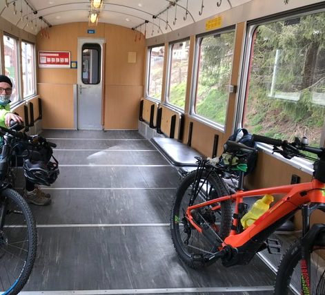
Additionally, the entire En valley is served by the picturesque Rhaetian Railway, well adapted for bike transport, making it very convenient to jump on and off at various villages.
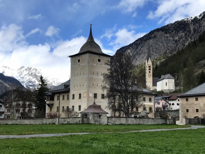
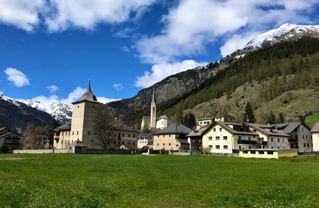
Zernez has only a few historic building, the most prominent of them being Wildenberg Castle, built initially in the 13th century and expanded in the 17th century. It can be visited only at specific times during guided tours.
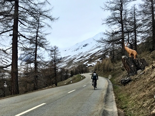
Leaving Zernez on Route 6:03 (and 65:02) in the direction of La Punt, the bike trail runs for a large part inside a pine forest.
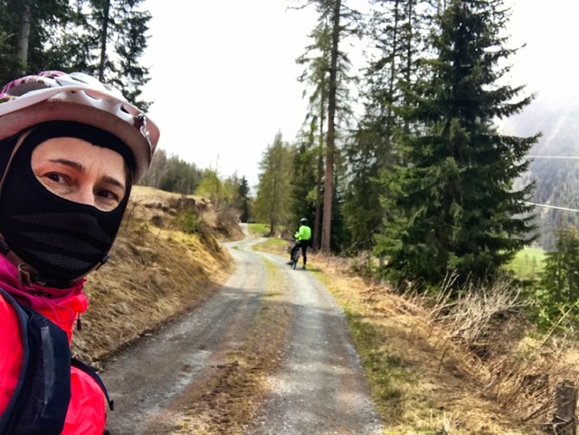
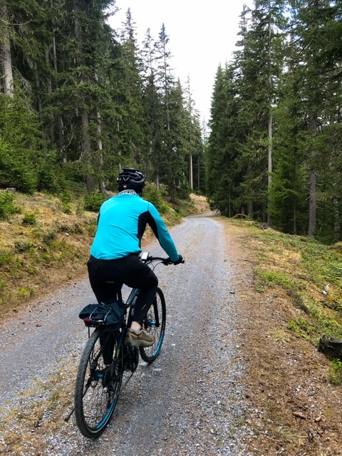
The trail remains fully immersed in nature for many kilometers.
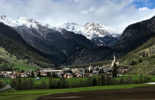
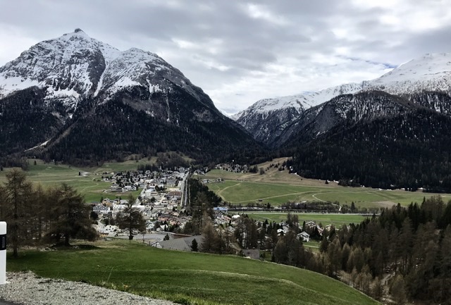
Then the path descends along the river En/Inn and enters the charming town of S-chanf (1662 m).
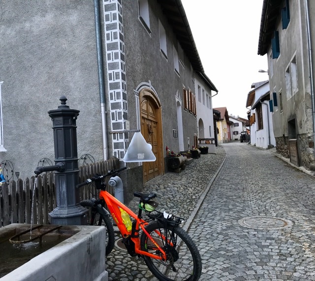
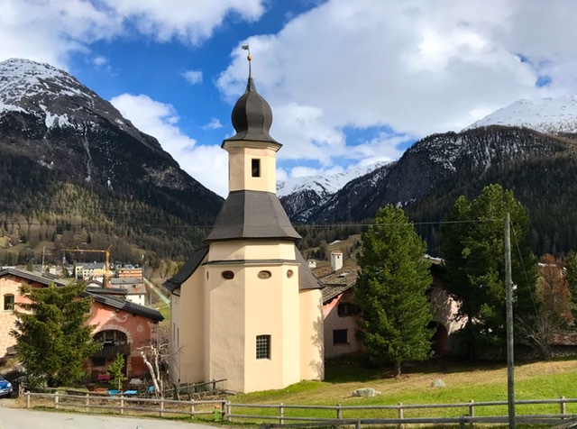
Here we wandered through the alleyways, enchanted by the beauty of its buildings. We now recognized the typical “sgraffiti” of the façades. Indeed, the village has incredibly picturesque houses, some dating from the 16th-17th century.


From there the ride continues along the river until La Punt (1,700m), another picturesque village with typical old Engadine mansions as testimony of its commercial past at the foothills of the Albulapass.
As the trail enters La Punt, one is greeted by an impressive white building with a peculiar shape. Initially I thought it was a church but it turned out to be a patrician villa (Chesa Merleda) built in 1642.

From La Punt we tried to climb over the Pass but, as mentioned earlier, we found the road blocked.
I cannot report on crossing the Pass and on the descent into Bergun, but SwitzerlandMobility.ch website gives great information ( https://www.schweizmobil.ch/en/cycling-in-switzerland/routes/route/etappe-0885.html ).
The pass itself was already in use in prehistoric times. It continued to be used as a trade route in Romans and medieval times. Then in the 19th century major construction and engineering work upgraded the route to what we know today.
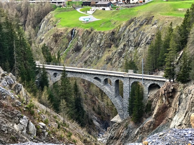
The road meanders through majestic open spaces and Alpine views and next to parts of the Rhaetian Railway ( see Route 6:02). The steepest part is the 14km-stretch between the Albulapass (2,312m) and Bergun (1,360m). In between sits the hamlet of Preda. Its train station is the last one in the Albula district before the Rhaetian Railway begins a series of spiral turns to reach the peak and then descends into the Engadin and St Moritz.
Links to Introduction and other Sections:
- BIKING THROUGH SWITZERLAND (with an electric bike)
- Route 6: Section 1 – Chur to Thusis
- Route 6: Section 2 – Thusis to Bergün
- Route 6: Section 4 ; part 1 – Zernez to Scuol
- Route 6: Section 4, part 2 – Scuol to Martina to Finstermünz Fortress
- Route 6: Section 5 – Thusis to Splügen
- Route 6: Section 6 – Splügen to San Bernardino
- Route 6: Section 7 – S. Bernardino to Bellinzona
