August 2020
DAY-2
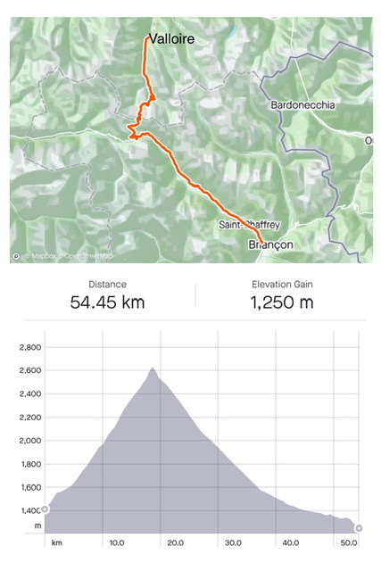
Stats: Valloire (1,400m) to Briançon (1,200m) via Col du Galibier (2,640m); length 54 km; elevation 1,250m. Battery used 70%
What a spectacular day!
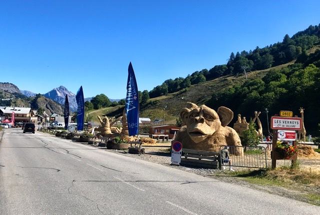
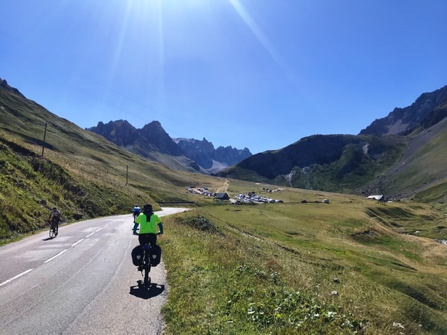
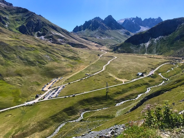
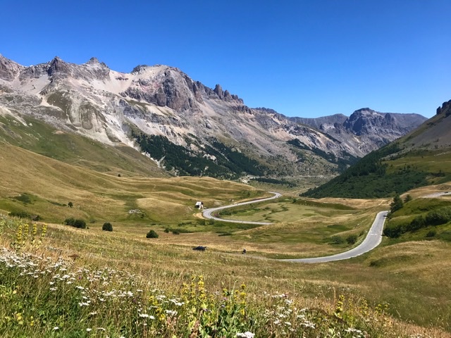
We started through a beautiful long green valley in the Valloire region, well equipped for the outdoor tourism.
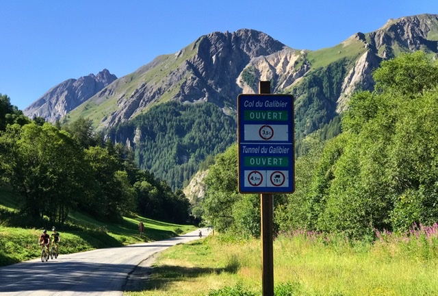
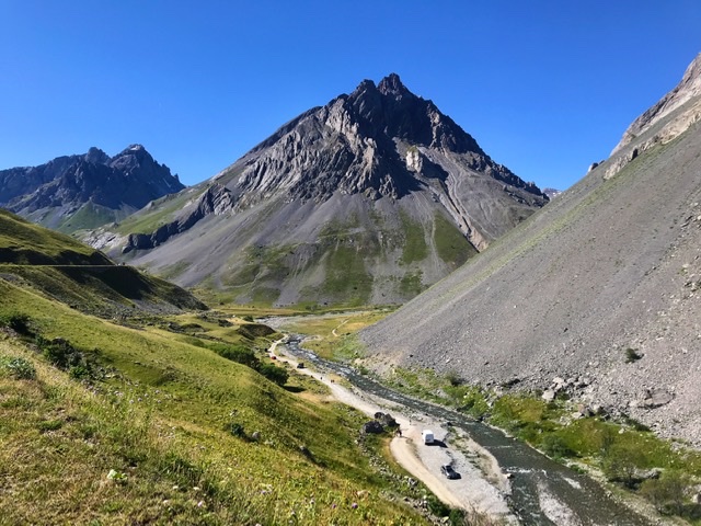
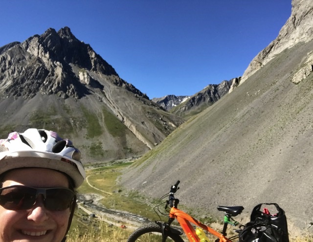
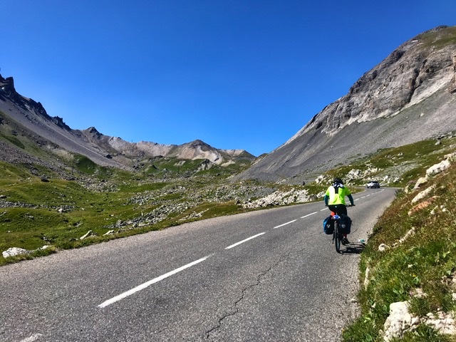
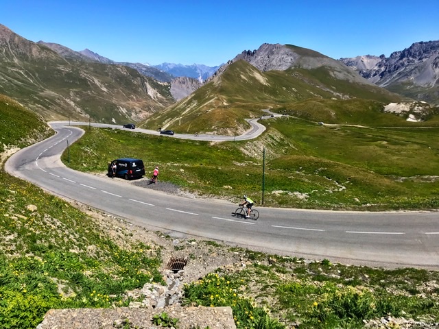
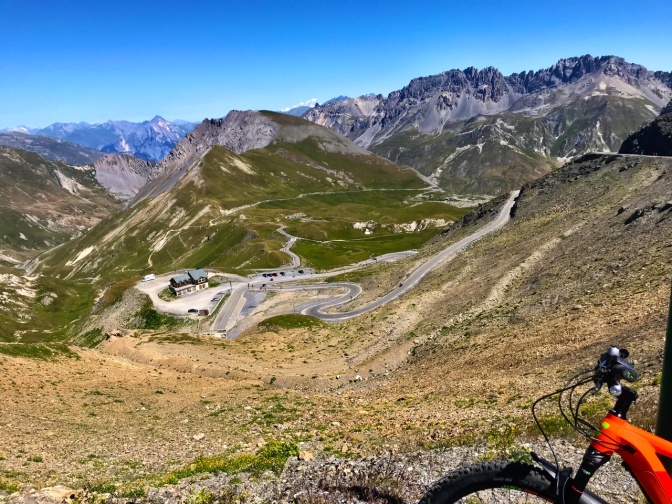
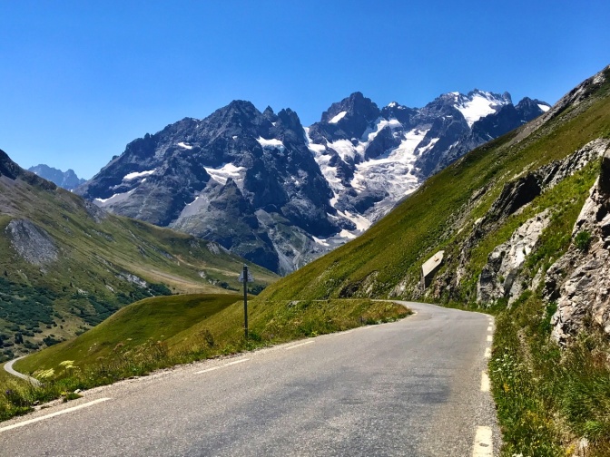
Rocky gray peaks and glaciers against a blue cloudless sky accompanied us on both sides of Col du Galibier (2,642m). The scenery was just breathtaking. This must be one of the most spectacular sections of the entire Route and is indeed one of the mythical stages of the Tour de France. It is probably why the number of cyclists on the road rivals the number of motorists.
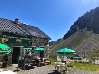
A welcome stop a few km before reaching the Col is a lonely little cheese shop selling local products.
Interestingly, at the summit, at 2,642m in the middle of this remote and isolated mountain range, there is a traffic jam with bikers lining up to take photos in front of the iconic Col signpost 🙂
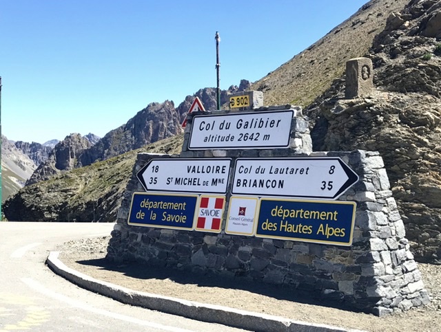
The Col du Galibier represents also the border between northern and southern Alps, between Savoie and Hautes Alpes.
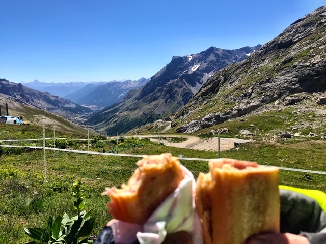
Once the hardest effort was behind us, we found a scenic spot where to rest and have a picnic lunch. This will become our routine for the days to come 😜
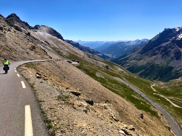
And then the fun starts …….
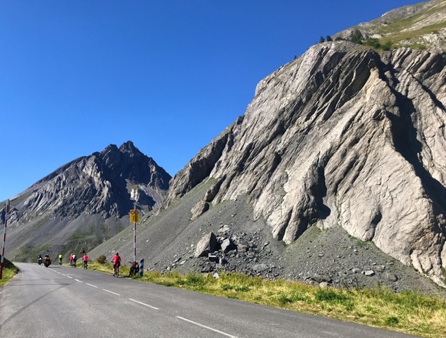
After the long and strenuous ascent to the Col, there are about 35km of an incredible freewheeling descent to Briançon.
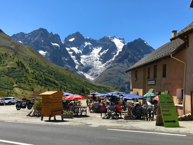
The initial descent is blessed by breathtaking views of majestic glaciers.
To take a break, just 8km below Galibier is Col du Lautaret (2,000m), a little touristic agglomeration set against an impressive natural backdrop of glaciers and rocky peaks. This is a nice place for a bite or coffee or other delicacies.
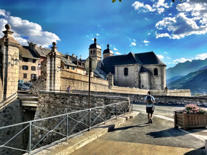
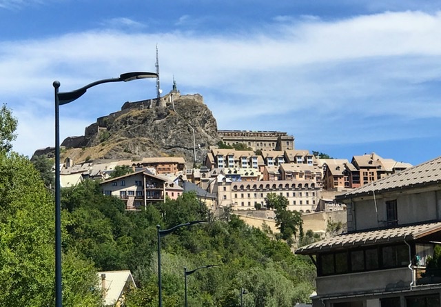
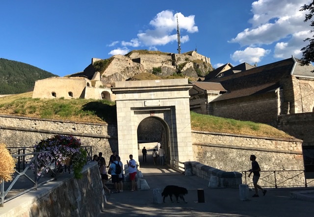
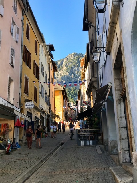
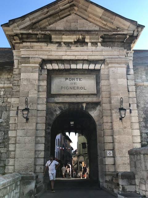
Arrived in Briançon, we visited its picturesque fortified old town (Cité Vauban), which sits on a hill overlooking the valley. It was built in the 17th century by Vauban as a defense post against the Austrians. Quaint small restaurant and tourist shops line its narrow steep alleys.
Links to other sections of Route des Grandes Alpes:
- INTRO- Route des Grandes Alpes , France (southern half)
- St-Michel-de Maurienne to Valloire , France (Day-1)
- Briançon to Guillestre , France (Day-3)
- Guillestre to Barcelonnette , France (Day-4)
- Barcelonnette to Guillaumes, France (Day-5)
- Guillaumes to Valdeblore , France (Day-6)
- Valdeblore to Sospel , France (Day-7)
- Sospel to Nice , France (Day-8)
