August 2020
DAY -3
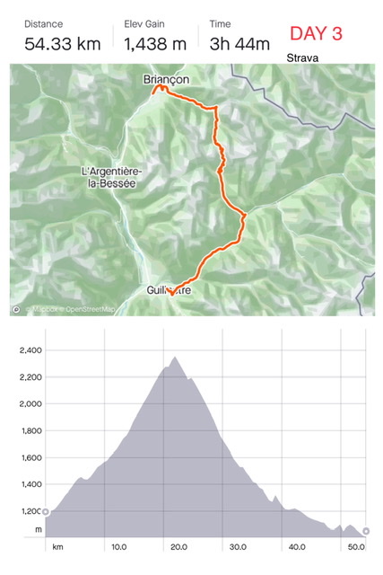
Stats: Briançon (1,200m) to Guillestre (1,050m) via Col d’Izoard (2,360m); length 54 km; elevation 1,440m. Battery used 70%
What a misfortune! The evening before we broke the battery /charge connection (Yamaha) in one of our bikes!
I spent the night trying to plan possible solutions …… find a shop that could sell us the same battery (Yamaha is a rare battery for ebikes and batteries are not usually in stock)……buy a new ebike……. find a train connection to Nice, our end destination (impossible because of works)…… find a train connection to return to Switzerland……. All the hotels had been pre-paid so we would loose money no matter the solution.
In the morning, when I was psychologically prepared to go back home, we had the incredible luck of finding a very helpful bike shop in Briançon (www.mountain-cycles.fr) that sold us a Yamaha battery removed from one of their new ebikes!
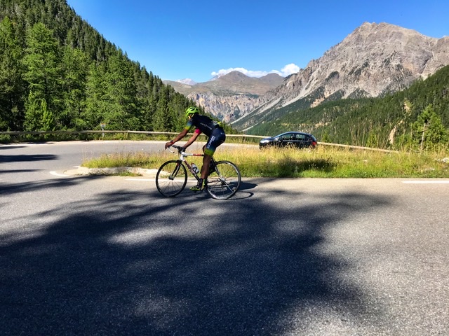
Thus set, under the hottest midday sun, we started our ascent to Col d’Izoard.
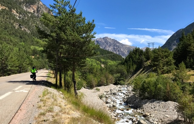
The road to the Col is beautiful: much quieter and greener and overall more bucolic even compared to the previous day. We biked through valleys crossed by streams and surrounded by pine trees and gray mountains.
An idillic spot for lunch, if we had to stop, was at the remote hamlet of Le Laus. But with our late start we decided to move along, wanting to reach the top.

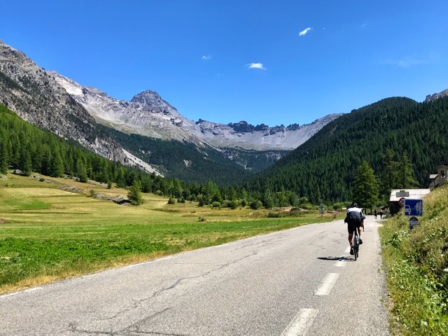
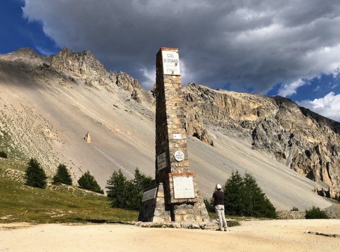
We finally stopped for picnic & coffee at Refuge Napoleon, 1km before the summit. The refuge was built in 1858 by Napoleon III against the backdrop of imposing sandy mountains.
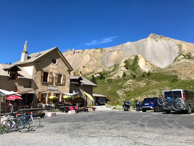
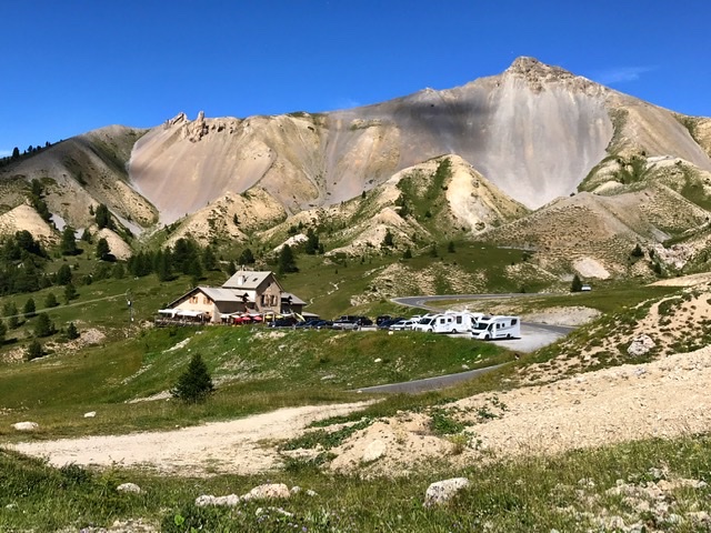
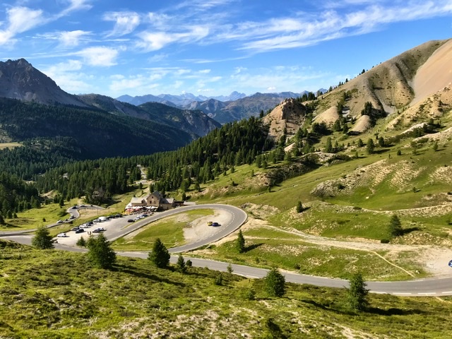
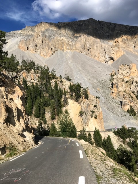
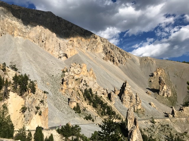
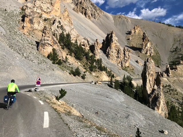
The landscape around Col de l’Izoard consists of an impressive mix of spiky rocks and gray sand-slides, an image reminiscent of the deserts of Arizona and Utah. We paused here in awe of this dramatic scenery.
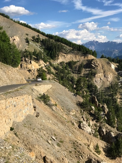
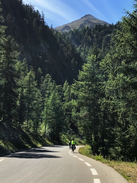
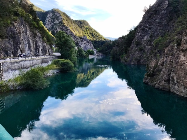
After the Col, the road enters the pristine Regional Park of Queyras (with its Chateau Queyras)

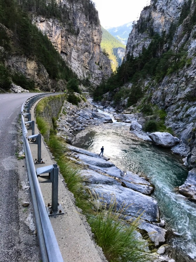
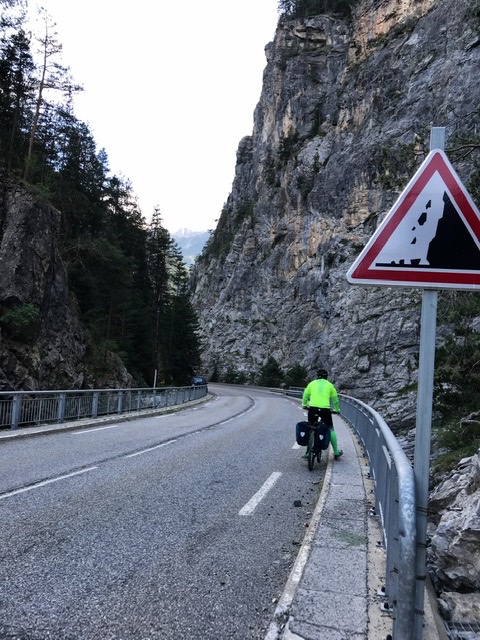
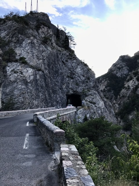
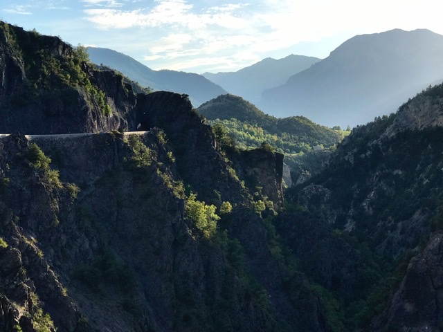
The 30km+ freewheeling descent passes through forested areas first, followed by breathtaking canyons sculpted by the rumbling Guil.
We reached Guillestre right on time for dinner.
Links to other section of Route des Grandes Alpes:
- INTRO- Route des Grandes Alpes , France (southern half)
- St-Michel-de Maurienne to Valloire , France (Day-1)
- Valloire To Briançon , France (Day-2)
- Guillestre to Barcelonnette , France (Day-4)
- Barcelonnette to Guillaumes, France (Day-5)
- Guillaumes to Valdeblore , France (Day-6)
- Valdeblore to Sospel , France (Day-7)
- Sospel to Nice , France (Day-8)
