Highlights: Andermatt, Devil’s Bridge & Schöllenen Gorge
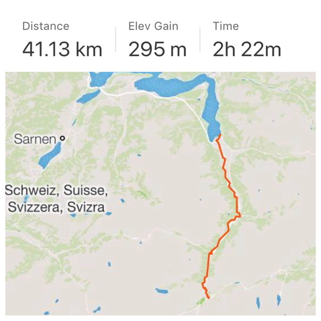
Route 3: Section 4 (Flüelen 434m–Andermatt 1,437m)
Stats from SwitzerlandMobility.ch (www.veloland.ch/en/routes/etappe-01650.html): 39km long, height difference Flüelen–Andermatt 1,150 m (but only 150m in the opposite direction because it is all downhill!!). Their site has the full profile. Shares its path with Eurovelo 5.
September 2019
What a difference from last week when it was freezing weather and snowing in Andermatt, while today is a gorgeous sunny late-summer day!
To start, I biked this Section in the opposite direction all in descent so the effort was minimal.
I began in Andermatt, Canton Uri (see 1:01), departing point for many Swiss Passes routes to the South, North, West, and East.
In this case, I took the road north towards Lake Lucerne in a continuous drop of 1,000m for about 40km.
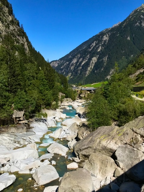
Right at the start, a couple of km from Andermatt, is the spectacular Schöllenen Gorge (Schöllenenschlucht) (https://en.m.wikipedia.org/wiki/Schöllenen_Gorge) excavated by the wild upper Reuss river. The impressive gorge is surrounded by imposing granite walls and crossed by the scary and very picturesque Teufels Brücke (Devil’s Bridge).
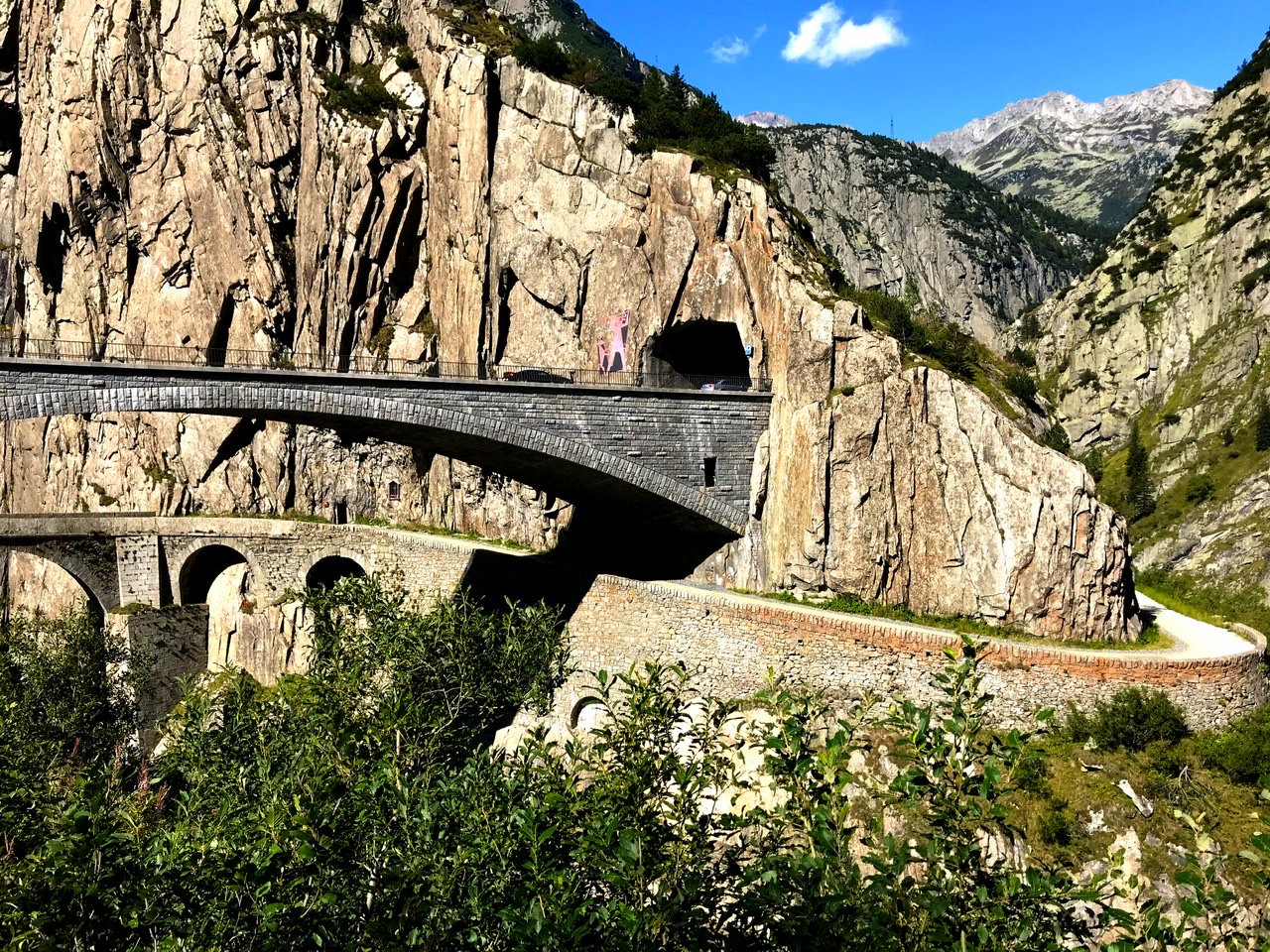
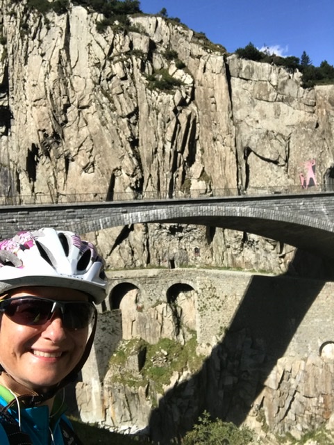
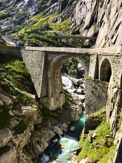
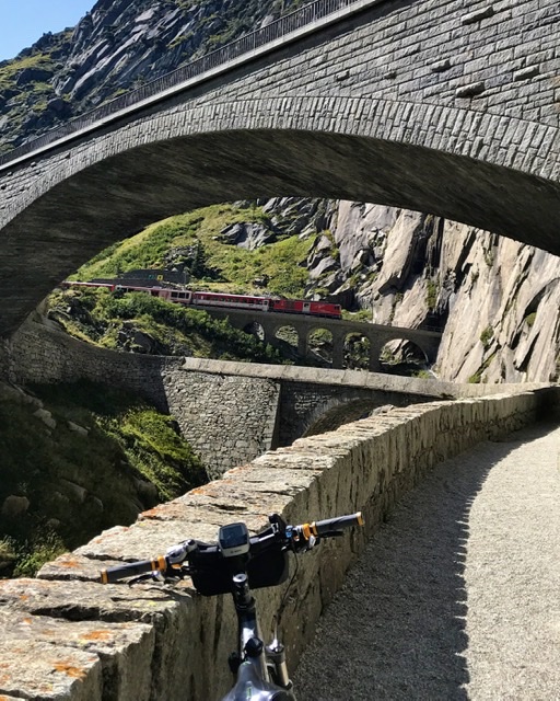

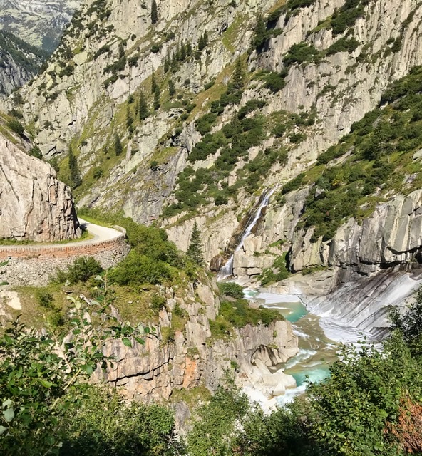
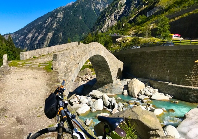
Turquoise pools of water make a beautiful contrast against the rocks. This canyon was for century a challenging obstacle for transit between the cantons of Uri and Ticino, in the journey towards Italy. Since the 13th century, more or less sturdy bridges have been built along this scenic canyon to allow travel to Italy via the Gotthard Pass (see 3:05).

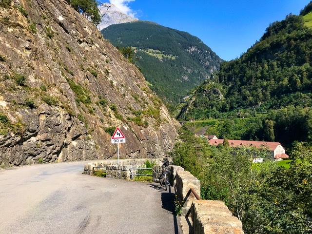
The road above the gorge is today extremely busy, with vehicles speeding in a frenetic race towards I don’t know what…. So, for a short part, I took a more scenic path along the Reuss, though unpaved and with some stairs. This must have been the medieval path because there were traces and stones from much older times.
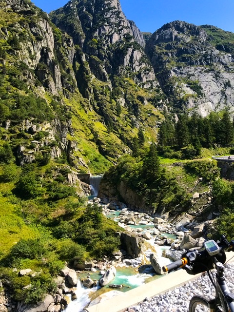
I took my time going through this route, stopping every minute to take photos. The landscape and the colors were so unbelievably gorgeous in this sunny day that I did not want this ride to end. I could have even walked my bike to make it last longer…..
And then, as the route descended, I passed by the village of Wassen with its little baroque church on a hill visible from afar.


The road continues along the Reuss river and between the mountains until Flüelen.
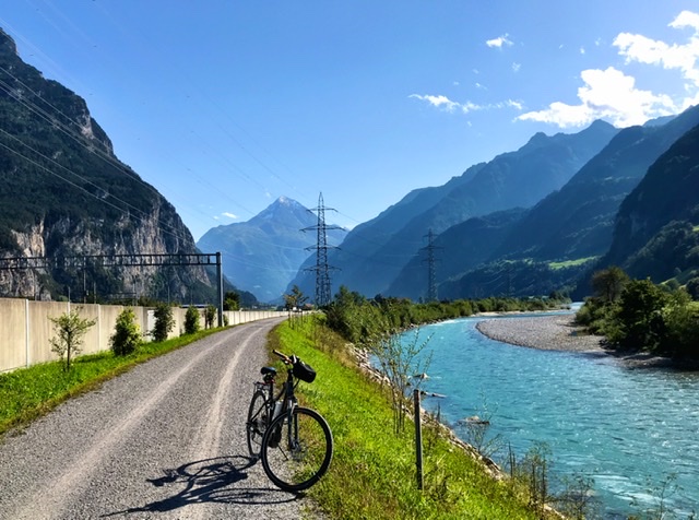
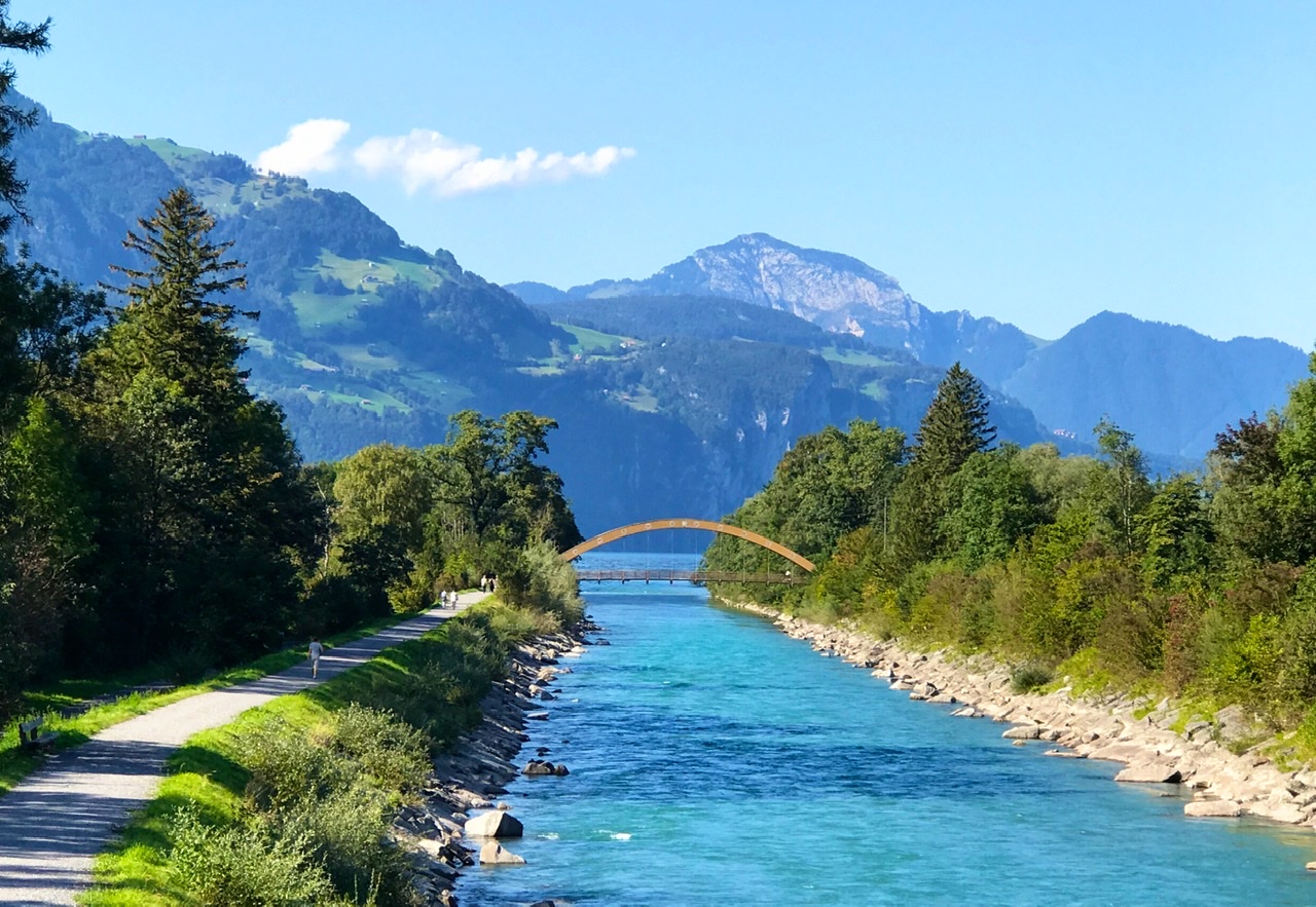
This small town sits at the southernmost tip of Urnersee, the eastern fjord-like section of Lake Lucerne. Here is also where the Reuss flows into the lake. The views of the tall steep Alps were just spectacular in this magical cloudless sky.
Since this ride required little effort, I then continued into the next Section (3:03) to Lucerne.
Links to Introduction and other Sections:
- BIKING THROUGH SWITZERLAND (with an electric bike)
- Route 3 (North-South): Section 1 (Basel-Aarau)
- Route 3: Section 2 (Aarau–Lucerne)
- Route 3: Section 3 (Lucerne–Flüelen)
- Route 3: Section 5 (Andermatt–Airolo)
- Route 3: Section 6 (Airolo–Bellinzona)
- Route 3: Section 7 (Bellinzona–Agno)
- Route 3: Section 8 (Agno–Chiasso)

6 thoughts on “Route 3: Section 4 – cycling Flüelen to Andermatt, Switzerland”